I’m stuck. Can’t think of how to accomplish a client’s request. Any ideas would be helpful! Here are my notes:
96x98 print on fabric to mount on wall. World map showing different locations of international company. Wants to highlight locations in Americas and Italy only. 3D looking without being 3D. Colors are dark blue, light grey and red. Maybe use flags for location markers. Legibility to be far for highlighted areas but close up for other locations. Likes the idea of having countries with locations to be blue and rest of map to be light grey. Maybe add topography to the world map to get 3D feel?? Not sure how to go about this without having to hand drawn the topography. I need the final product to be high resolution or vector. Vector being better of course.
This is the kind of work I’d turn down. I know that’s not a helpful response, but they’re not looking for a designer. They’re looking for someone to bring their clumsy ideas to life.
Why does it need to be on fabric? Why does it need to be that exact size? Why have the colors been predetermined? They might be their corporate colors, but they’re not map colors. Why do they want their locations in blue? Blue on a map typically indicates water. Why do they want everything else to be grey?
They’ve already designed it. They just want to rent a pair of hands to fill in the details.
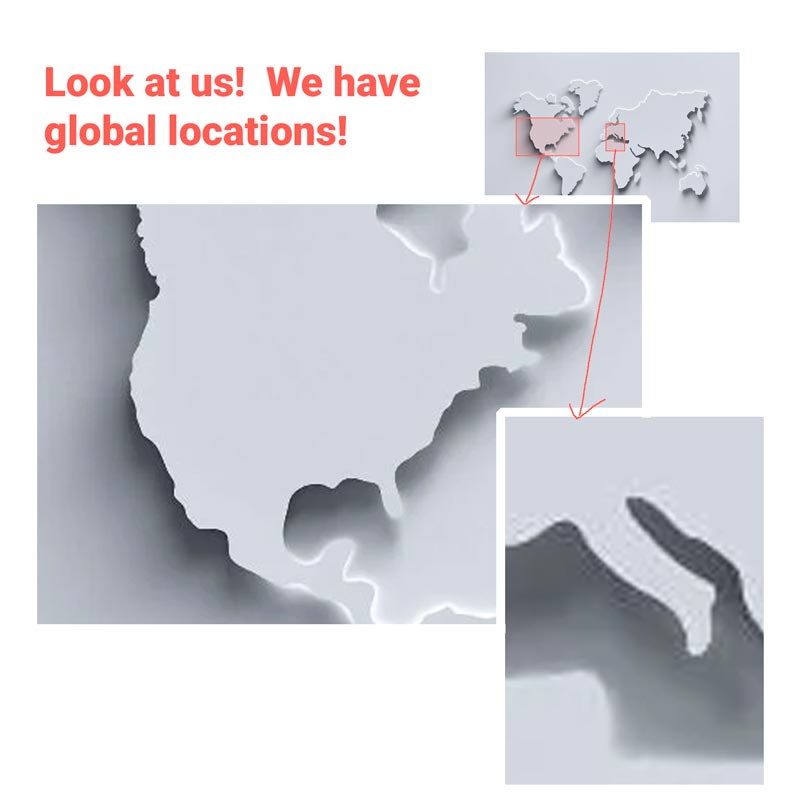
My only criticism would be if it is a world map, and you’re highlighting US and Italy locations only, it may be sparse. I’m sure you are trying to showcase that it is global, but you may be better off showing a smaller globe-like map with enlarged highlighted areas of Italy and the US that can then have a more detailed map of locations for those two countries.
This is my ugly quick way of explaining what I mean. And then put your flags, stars, whatever you want you location marker to be in the specific US and Italian locations on the closer maps.
Unless they are rapidly expanding and growing. And if that is the case, print out the “base” map and then think through what you could do to physically add a pin, flag, sticker, etc. on the map to show each location as it grows.